He was probably born in Przechówko and lived his adult life in Deutsch Konopat, Jeziorki, and Franzthal (Neumark). I've been lucky enough to visit all these locations
This map shows Przechówko (map is from the early 20th century and the village is labeled Wintersdorf). Deutsch Konopat is the village immediately west of Przechówko (today = Wielki Konopat which means Large Konopat in English). Klein (Small) Deutsch Konopat was the 4 lots of the village to the far east, bordering Przechówko. From the mid 17-teens, Jeorgen lived at Klein Deutsch Konopat #1, on the map below marked in blue.
[2676 (alt. 1263) Kulm (Weichsel) (1:25 000 Topographische Karte (Messtischblatt) cz. wsch.(Ostdeutschland) /1870 - 1945/), cropped]
There's a road along the border between Przechówko and Wielki Konpat which marks the valley between the two villages. This photo looks south down the road which heads downhill toward the Vistula River. Jeorgen's meadowland would have been the area in the photo to the right of the road.
In 1727, Jeorgen moved to Jeziorki (in the early 20th century map below, marked as Jeziorken), today a distance of 15 miles to the northwest by road. We don't know exactly where Jeorgen lived within this village nor where the Mennonite church was located. The road ran northwest to southeast (marked in green). The cemetery was (is) located centrally (marked in blue) and the current church at southeast (marked in yellow - could the Mennonite church have been located at the same spot? The road goes roughly along the top of a ridge with the land falling away in elevation to either side. Houses were situated on either side of the road. The cemetery was (is) also located at a high spot on village land.
[2575 (alt. 1171) Heinrichsdorf (1:25 000 Topographische Karte (Messtischblatt) cz. wsch.(Ostdeutschland) /1870 - 1945/), cropped]
Jeziorki cemetery is located in the patch of trees beyond the field:
The modern church in Jeziorki at the southeast edge of the village. Could it stand in the same spot where the Mennonite church did?
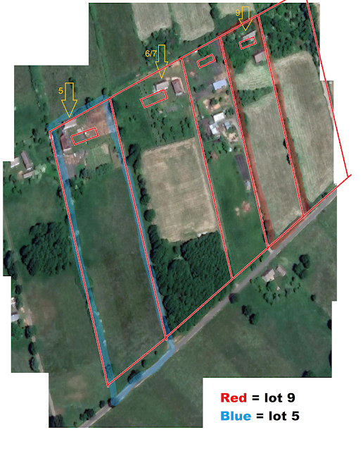
In 1765, Jeorgen moved to Franzthal, Neumark, a distance of approximately 140 miles by today's roads. Jeorgen lived initially at lot #9, then lot #5. This map shows the village in the very early 20th century. Lot #5 is marked in green, #9, in yellow. The modern church is marked with blue. The modern church is in nearly the same spot where the Mennonite church was. The Mennonite cemetery occupied the modern churchyard.
[3160 (alt. 1637) Driesen (West) (1:25 000 Topographische Karte (Messtischblatt) cz. wsch.(Ostdeutschland) /1870 - 1945/), cropped]
This map is an overlay of the old village Franzthal over the modern village Głęboczek. Blue numbers are current lot numbers, red numbers are Mennonite-era lot numbers. Here we can see that 9 is modern-day 23 and 5 is modern-day 26.
This is the modern house at 23/9. It is an old, dilapidated house, built during the first half of the 19th century according to information at https://zabytek.pl/pl/mapa. It's an old house, but not a Mennonite house. It must have been built after 1834 when the Mennonites left.
This is the modern farmyard at 26/5: house to the left (west) and barn to the north, forming a tidy, square yard. The Mennonite-era house, where Jeorgen lived and probably passed away, stood roughly in the center of this yard.
The Mennonite cemetery occupied the space currently taken by the churchyard. This photo shows the church, looking at it from the north. The cemetery would have occupied the space in the foreground.


No comments:
Post a Comment