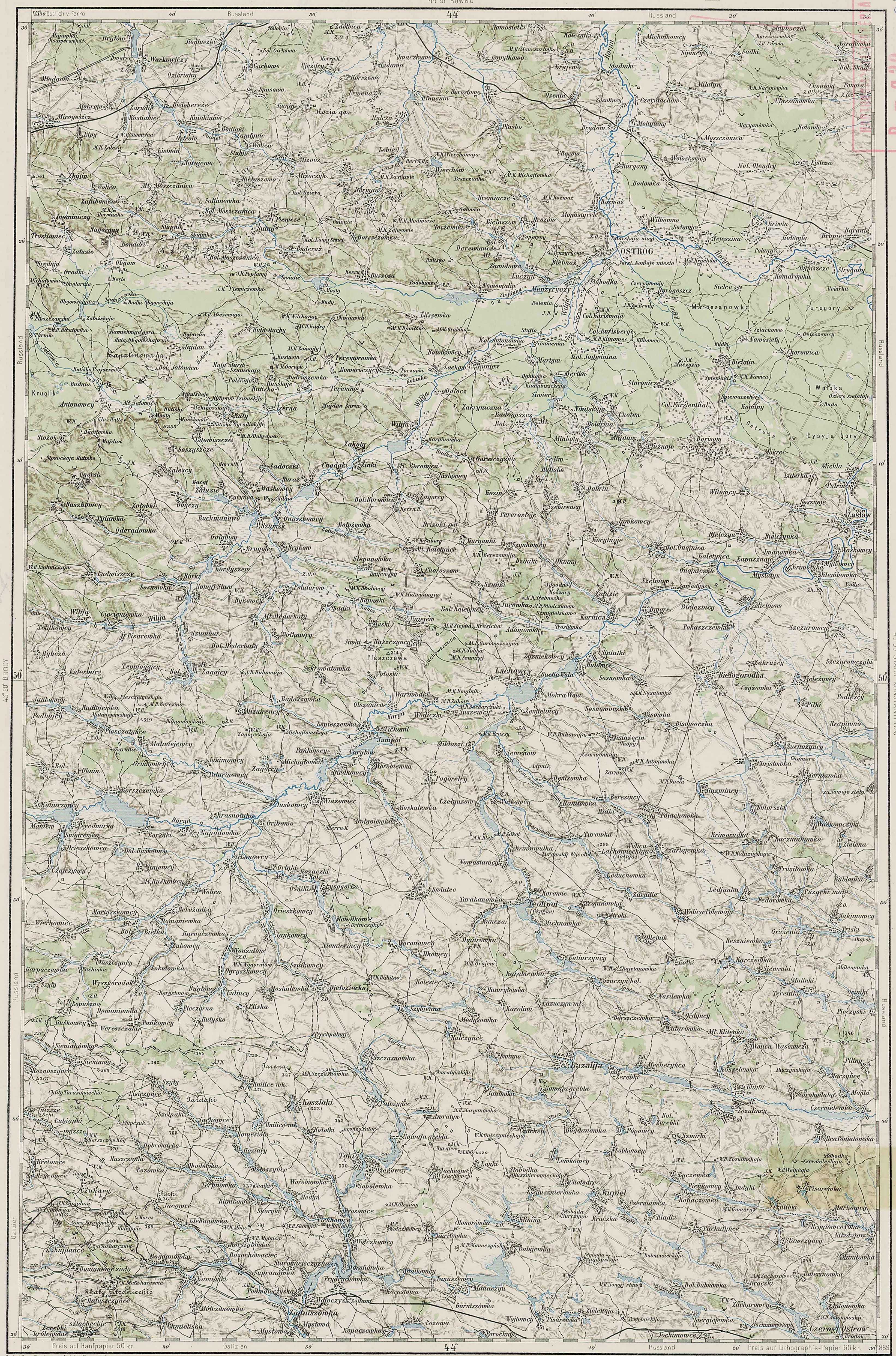
The village of Leeleva was located on the main road that ran
from Kamenka to Pluzhnoe. Travelling
generally south-southeast, one would have passed out of Kamenka, through the
forest, over a couple large hills and then downhill into Dertka. From there, the road went again straight
south, over a large hill, and down into Siver.
This stretch of road passed between two small lakes which were drained
probably in the 1940s. Leeleva lay just
south of Siver, at an elevation of about 210 meters. The main road through the village went
generally uphill and continued on to Miakoty, less than a mile to the south,
which is at an elevation of about 220 meters.
This road continued on to Pluzhnoe, another 3 miles farther east. Two
hills rise just to the south of the houses of Leeleva, the taller of which
rises over 240 meters. The distance by
road from Kamenka to Leeleva was almost 4 miles and in the 19th
Century would have been almost entirely through forest. The main road through Leeleva ran northwest
to southeast. Another east-west road ran
through the village; west to Mala (small) Radogosch and east to Balyary. Some researchers seem to have combined Leeleva with Siver; this appears to be incorrect. Based on current satellite views as well as old Polish, Russian and Austrian maps, Siver (today known as Syvir; Ukr: Сйвір) is a separate village immediately adjacent to Leeleva to the northwest.
German: Fuerstendorf
or Fürstendorf (Russian: Фюрштендорф;
Ukrainian: Фюрштендорф),
Russian: Lesna:
(Ru: Лесна or Лѣснa; Ukr: Lisna, Лісна; Polish: Lisna),
Also known as Lesnaja
(Ru: Лѣсная or Лесная; Ukr: Лiсня), or Liesnaja or Lesnaya,
Leeleva (Ru: Лелева;
Ukr: Лелевой) or Lileva or Lilewa,
Also known as Lebwa, Nikitskaya or Nikitska.
There may be confusion about the name of this village as
lesna/lisna is a term for “forest” in Russian and Ukrainian. Further, the forest south of Ostrog may have
been named Nikitskaya Forest at some point in time. German-speaking cartographers of the late 19th
Century may have confused the village and the forest and mistakenly labeled the
village Nikitskaya instead of the forest (Jewish sources name a forest near
Ostrog Nikitsky or Nikitin).
Established as early as 1765 by Ukrainians or Poles, the
earliest appearance of the village in Mennonite sources (under its German name:
Fuerstendorf) is 1874. My Ratzlaff Family tradition suggests that
Ratzlaffs lived in this village, which they called Leeleva, by 1869.
This village was the last home of the Mennonite colonists in
the Ostrog area. As the majority of Mennonites
left the other nearby villages in the last quarter of the 18th
Century, those who stayed behind consolidated in Leeleva. German Lutheran colonists began moving into
the village as the Mennonites left for America.
The Lutheran Church fell under the authority of the Rivne Lutheran
Parish. Early 20th century
Mennonite sources state the Mennonite Church in Leeleva was affiliated with the
(Neu) Alexanderwohl Mennonite congregation, which suggests a connection between
this village and Polish (Royal Prussian) Przechowka. A 1930s map of Lutheran Leeleva indicates
that the area to the east of the village was used as communal meadow. A road to the west of the village,
Teppergasse, seems to indicate the presence of a tavern or a brewery/distillery
of some sort while the road to the east, Entenquak, suggests a duckfarm or
something similar. The Lutheran map goes
on to indicate the cemetery on the west side of the road, mid-way through the
village, with the church directly across the street to the east. My own Ratzlaff Family tradition indicates
the houses in the village were offset one from another in order to prevent
fires spreading from one yard to another.
A 1906 census of the region included a village by the name
of Lesnaya (Лѣсня) as well as one by the name of Leleva (Лелева). The population of Lesnaya was listed as 267
in 52 households and Leleva as 244 in 26 households. Both were listed as falling under the
jurisdiction of the 3rd police precinct of Ostrog County. At this point I have no idea why 2 villages
were listed in this census.
The German inhabitants of the village were known as skilled
farmers and blacksmiths. From at least
1889, as indicated by an Austrian map of that date, these farmers may have
taken their grain to be milled at a watermill located at nearby Siver. If, that is, the landlords of the tenant
farmers allowed it. After the Russian
Revolution, the council of the village continued to use the German language
until the 1930s, but most Germans were evicted by the year 1936 (30 German and
Polish families were evicted at this time, perhaps to Kazakhstan). Leeleva was placed by the Soviets in the
collective which included Dertka, Siver, Jadvanin, and Mikhaylovka.
In 2001, the population of the village was 97 people. The village today is in the Ukrainian
Khmelnytsky Oblast or Province (Хмельницька
область), Izyaslav Raion or District (Ізяславському
районі), Dertkivska Village Rada or Council
(Дертківська сільська рада).
http://www.wolyn.freehost.pl/mapy/wig_wolyn.html
http://home.arcor.de/pulin/karlswalde/tips.htm#Fuerstendorf
http://home.arcor.de/pulin/karlswalde/tips.htm#Fuerstendorf
Green Ratzlaff Book
Abe Unruh, The Helpless Poles
Lutheran Lesnaya map
Mennonite Leeleva map